
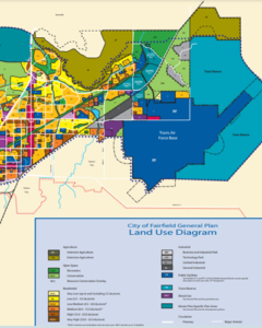
Fairfield
Fairfield is in central Solano County, and it is the second largest city in the county and is the county seat. It is generally considered the midpoint between cities like San Francisco and Sacramento and is home to Travis Air Force Base. Interstate 80 passes through Fairfield. City boundaries include State Route 12, which connects Fairfield with Napa to the west and Rio Vista to the east. The city is also flanked by the capital corridor train operated by Amtrack California.
On this page, you can learn more about Environmental Hazards in the informative brochure below (click either image to download a print-quality version); about Pollution Indicators that affect local communities; City Efforts, including plans and commissions; an Environmental Directory of community organizations; and the involvement of Sustainable Solano Programs in Fairfield. (Click on the previous links to jump to that section of the page.)
")
 (1)")
Pollution Indicators
The California Communities Environmental Health Screening Tool is used to evaluate communities based on pollution burdens and the characteristics of people living in these communities. This information helps identify California communities that are most affected by different sources of pollution. Each of the data points below represents a value for a census tract as it compares to other census tracts in California. Census tracts are small, relatively stable statistical subdivisions of a county and usually contain between 1,200 to 8,000 people, with the optimal size of 4,000.
Focus Census Tracts
This is a sampling of census tracts within the city of Fairfield with color-coded indicator dots to reflect the pollution and socioeconomic indicators for each. Scroll through to see the different indicators for each census tract.
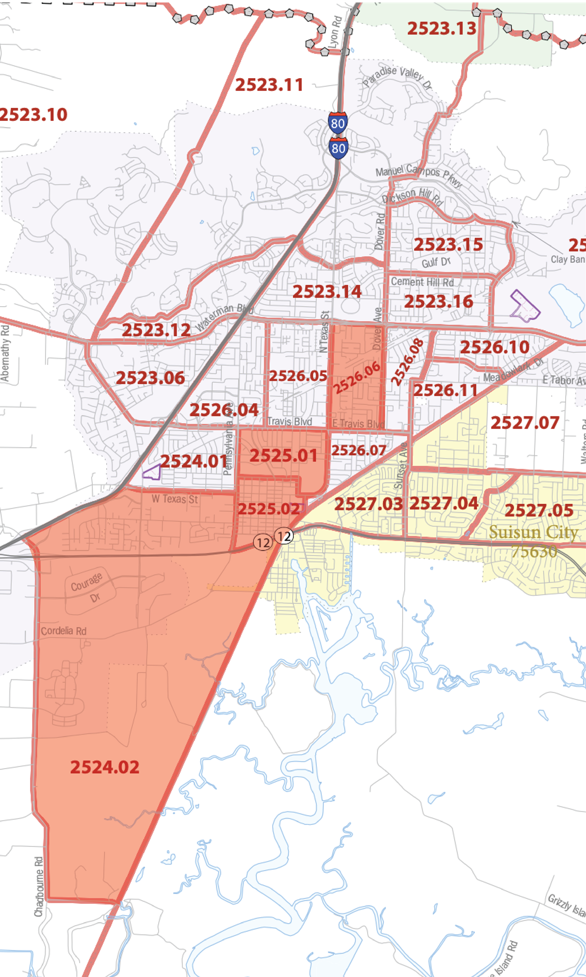
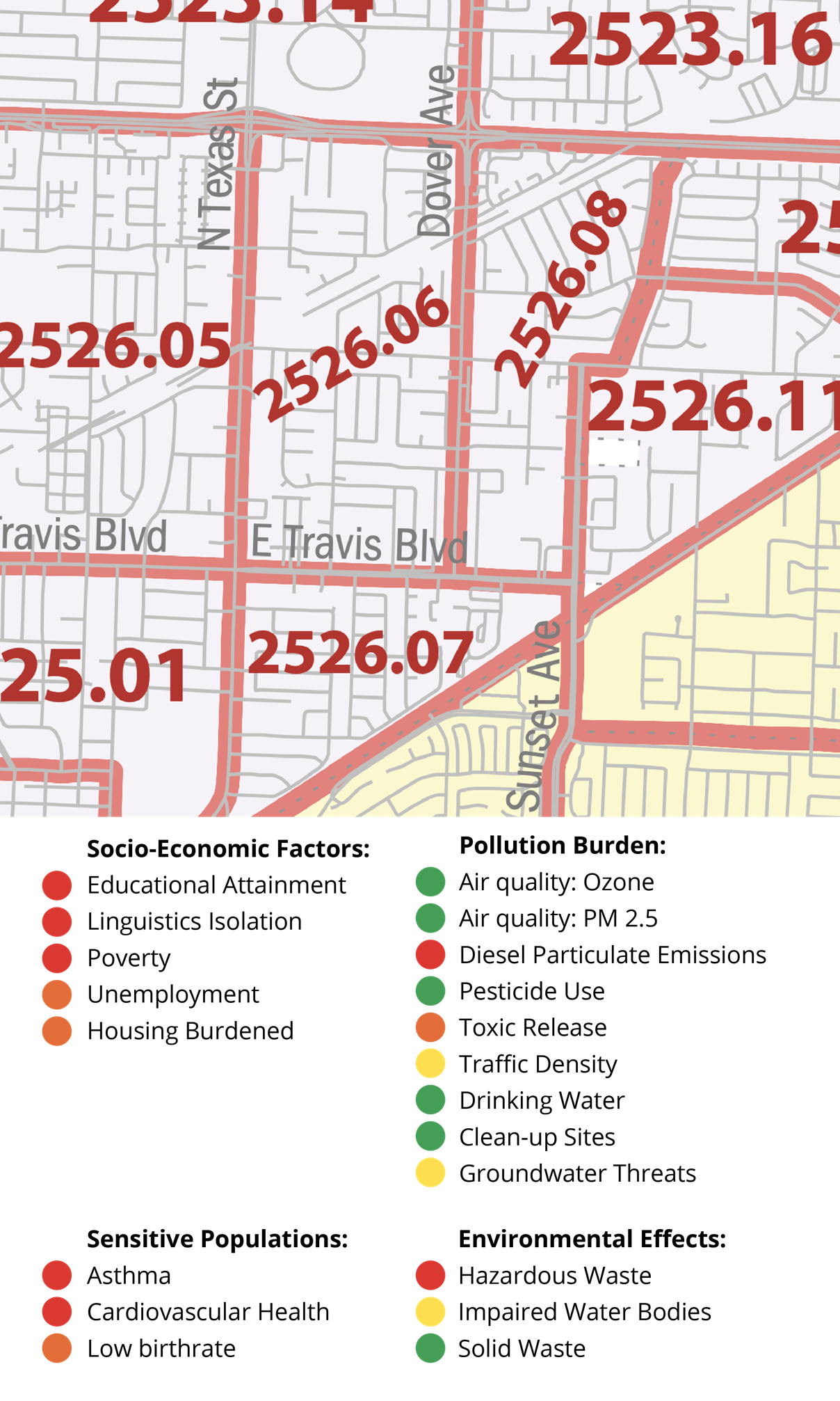
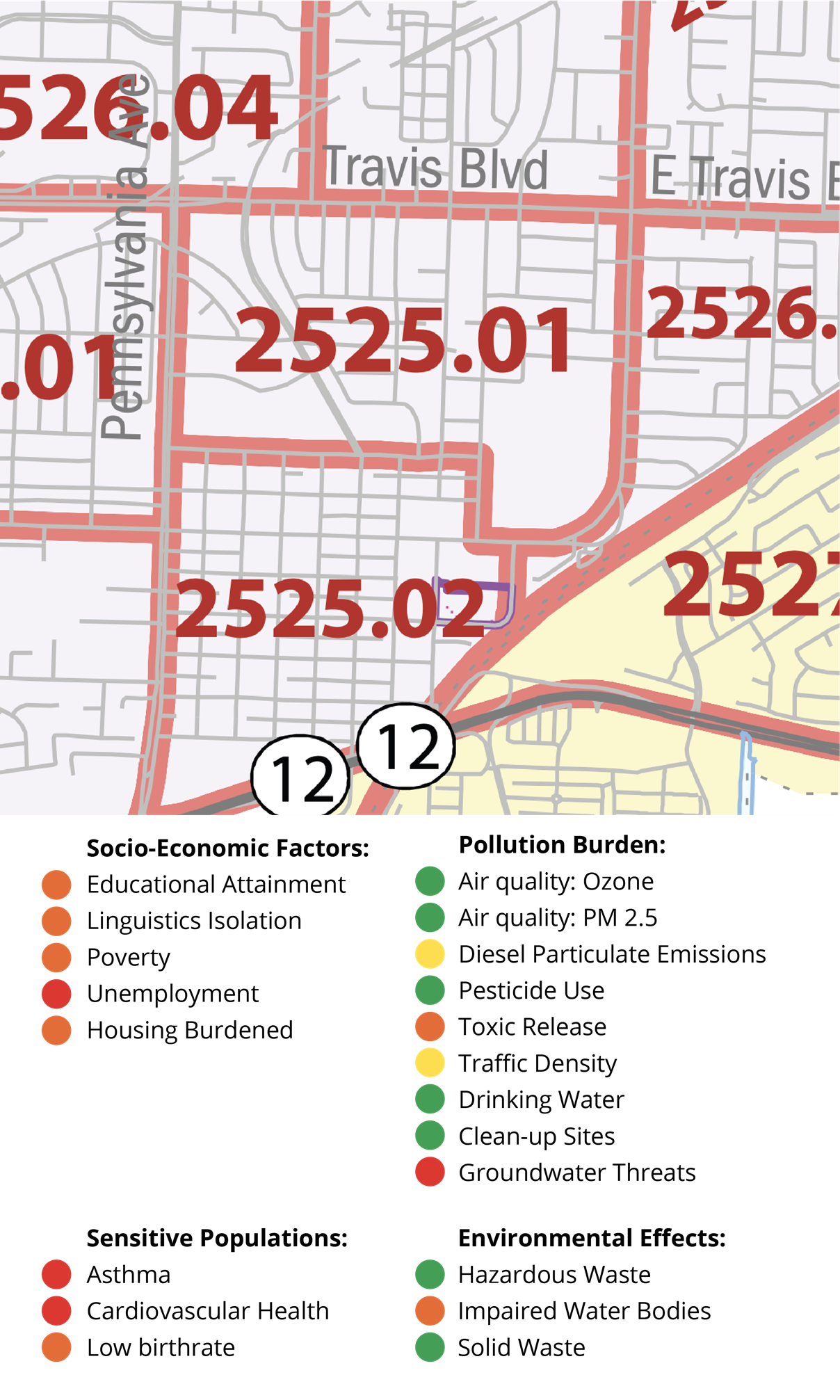
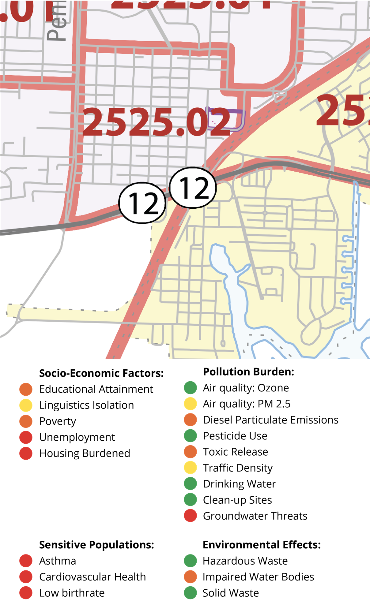
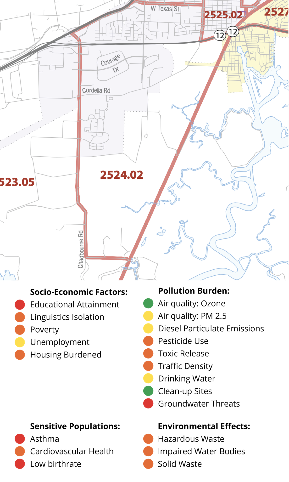
The information has been color-coded to reflect the severity of each pollution and socioeconomic indicator:

To view complete and more detailed information for your census tract, visit: https://oehha.ca.gov/calenviroscreen/report/calenviroscreen-30
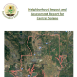
Focus Neighborhoods
These neighborhoods were selected using careful analysis of pollution burden and population characteristics indicators found in the CalEnviroScreen3.0 database. Each indicator is a measure of environmental conditions or health and vulnerability factors.
Zoom in and select a neighborhood on the map to get important environmental and socioeconomic information.
Learn more about the indicators in this summary document or on the CalEnviroScreen site.
The census tracts with higher pollution burdens and population characteristics indicators were compared to the Nutrition, Education and Obesity Prevention Branch GIS Map. This database includes different demographics, including census blocks of people living under the federal poverty level.
It was using these two databases that the final neighborhoods were picked.


Air Quality
Learn the effects of poor air quality on Fairfield and efforts to improve it through the Youth Air Protectors and community projects and planning.
Solano Sustainable Backyards
Learn about these waterwise edible gardens in Fairfield and around the county.
Solano Gardens
Learn about the Solano Gardens program and these edible gardens that bring healthy produce to local communities.
Sustainable Landscaping Sites
Have a site for a project in Fairfield? Fill out our Sustainable Landscaping Interest Form.
Get Involved!
Interested in volunteering with Sustainable Solano in Fairfield? Fill out our volunteer interest form.